LaunchMyDrone Call

Services

What we do

From search and rescue to real estate, with drones that carry thermal cameras and spotlights. Not sure which service you need? Call and tell us about the job.

Search and Rescue

Search and Rescue Support

Custom quoteBy the hour or by the mission

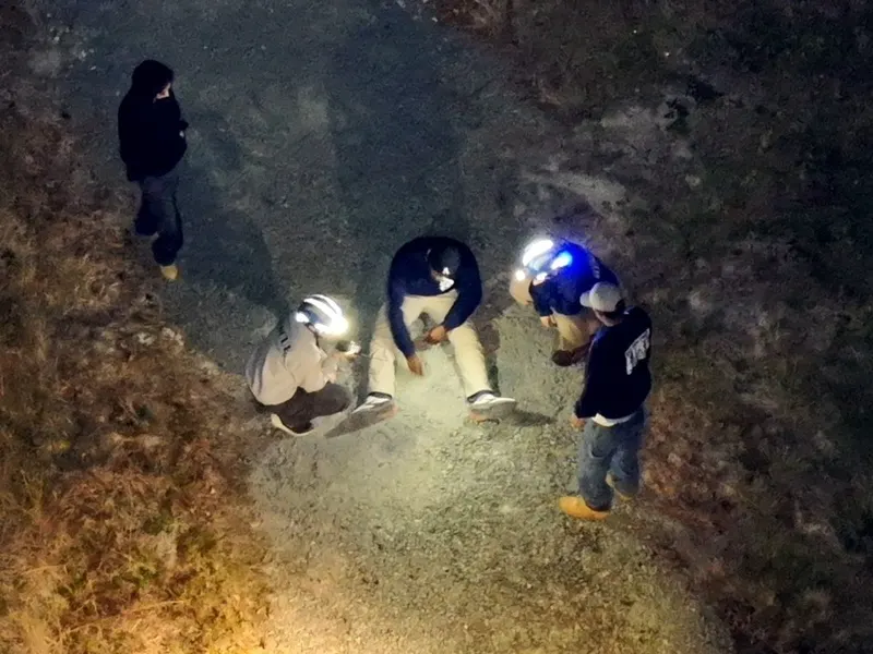
We fly alongside search and rescue teams and first responders. A drone covers ground in minutes that would take a team on foot hours, and the thermal camera picks up body heat through brush and darkness. At night, the spotlight drone lights the way for the teams on the ground.

  • Missing person searches, day or night
  • Lighting up an area for ground teams
  • A live view from above for whoever's running the search
Call about a search
Searchers on the ground at night, lit by the drone's spotlight

Lost Deer Recovery

Starting at $249

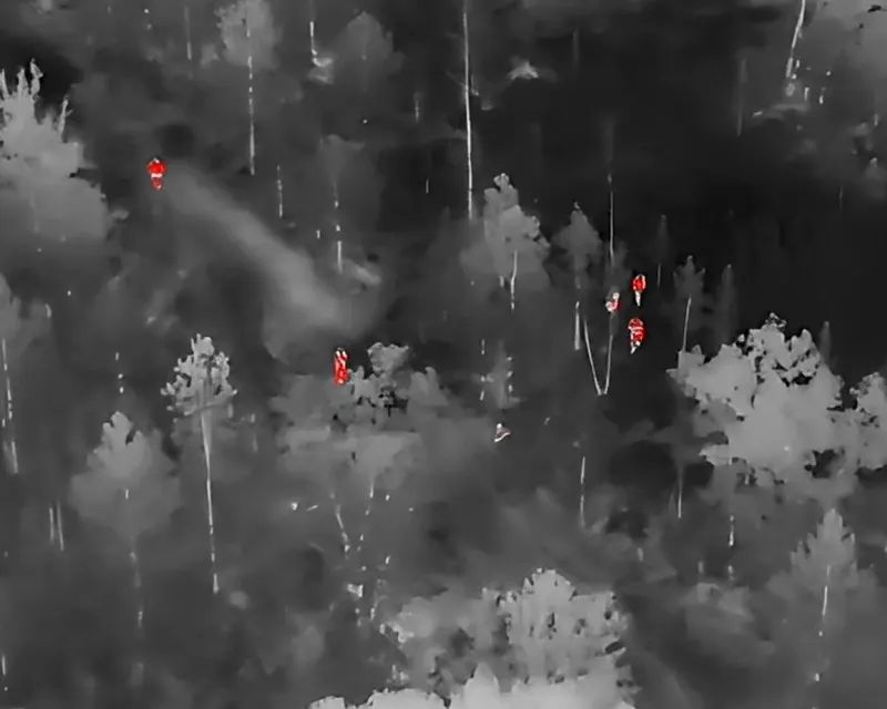
Made a good shot but can't find your deer? The thermal camera picks up its body heat, even in thick cover or after dark, and we guide you straight to it. Less time searching, and less meat lost.

  • The blood trail ran out
  • Thick cover, swamps and steep ground
  • Searching after dark
Call about a deer
Thermal camera view over a forest, where warm bodies show up as bright spots

Drones and deer in North Carolina

Allowed

  • Finding a deer after it's been legally shot
  • Mapping and photographing your land before the season
  • Farm, timber and land management photos

Not allowed

  • Using a drone to find, follow or chase live deer
  • Pushing deer toward hunters
  • Spotting deer from the air so someone can take a shot

Rules can change. Check the current hunting regulations at ncwildlife.gov.

Lost Pet Search

Starting at $225

A scared dog or cat often hides and won't come when called. From above, with a thermal camera, we can check fields, woods and ditches fast, especially at dusk and after dark, when the heat shows up best.

  • Dogs and cats that ran off or got spooked
  • Livestock that got out
  • Big properties that are hard to search on foot
Call about a lost pet

Major Disaster Support

Call for a quote

After storms, floods and fires, we help responders and communities see what's happened: which roads are blocked, where the damage is, and where people may need help. Photos and maps from the air, fast, when it isn't safe to go in on foot.

  • Damage photos and maps for responders
  • Checking roads, bridges and power lines
  • Helping find people who need help
Call about disaster support
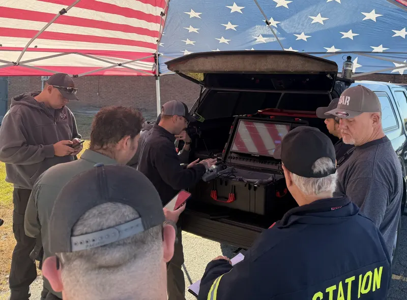
Search team members gathered at the back of a truck under a flag-print tent

Inspections and Mapping

Roof Inspections

Starting at $299With thermal $475

Clear, close-up photos of your whole roof without anyone climbing a ladder. Great for spotting storm damage, missing shingles, and flashing or gutter problems, and for insurance claims.

  • Homeowners after a storm
  • Roofers giving estimates
  • Insurance claims and adjusters
Call about a roof

Cell Tower Inspections

Starting at $450

Detailed photos and video of antennas, mounts, cables and hardware, from every angle, without sending a climber up first. Faster, safer, and you get a full record of the tower's condition.

  • Routine condition checks
  • Checking for damage after storms
  • Photos before and after work on the tower
Call about a tower

Agriculture Support

Starting at $250

See your whole operation from above. We help farmers check crops, spot problem areas like poor drainage, pests or storm damage, count livestock, and keep an eye on fences and ponds.

  • Crop checks through the season
  • Finding wet spots and drainage problems
  • Counting and finding livestock
Call about your farm

GIS Mapping

Starting at $350Or by the acre

We fly a planned grid and stitch hundreds of photos into one detailed, high-resolution map of your land or job site. Useful for planning, measuring, tracking construction and keeping records.

  • Land and property maps
  • Construction progress over time
  • Measuring areas and planning projects
Call about a map

Real-Time Image Mapping

Call for a quote

Need a map right now, not tomorrow? We build a map of the area while the drone is flying, so search teams and incident commanders can see the ground as it is today and plan on the spot.

  • Searches and emergencies
  • Big events and incidents
  • Any job where the map can't wait
Call about live mapping

Photos and Video

Property Pics

Starting at $299

Beautiful photos of your land, farm or home from the air. Perfect as a keepsake, for tracking a build, for checking on land you can't easily walk, or just for seeing your place from a whole new angle.

  • Homes, farms and land
  • Build and renovation progress
  • Gifts and keepsakes
Call about photos

Real Estate Photos and Video

Photos $299Photos + short video $549

Make a listing stand out. Photos and video from the air show the whole property, the lot, the neighborhood and what's nearby, which photos from the ground can't.

  • Listings for agents and sellers
  • Land and acreage for sale
  • Video tours for social media
Call about a listing

Pricing

All jobs are quoted based on the specific needs, location, and timing of the work. The prices with each service above are starting points for common jobs in the Mebane / Alamance County area.

Add-ons

  • +$75Night or thermal-focused flight
  • +$100Written findings report
  • +25–50%Rush or same-day service

Travel within 20 miles of Mebane is included. Jobs beyond 20 miles are quoted with a small travel fee.

Need a quote? Call or text for a clear price on your specific job. Most quotes are provided the same day.

Ways to pay

  • Cash
  • Zelle
  • Cash App
  • PayPal
  • Visa
  • Bitcoin

Booking a job?

Download our services agreement, fill it in on your phone or computer, and email it to info@launchmydrone.com. You can also print it, sign it, and text a photo to 919-886-SPOT.

Download the agreement (PDF)

Get in touch

Need eyes in the sky?

Call or text for a quote, or just to ask whether a drone can help.

  • 919-886-SPOT (7768)info@launchmydrone.com
  • Based in Mebane, NC. Serving Burlington, Graham, Hillsborough, Elon and the rest of Alamance and Orange counties, plus the surrounding area. Travel within 20 miles is included.

Searching for someone right now? Call, don't email.